With winter fast approaching, icing during a flight should be a concern in the back of every pilot’s mind. After all, ice can quickly build up during a flight and this can be particularly dangerous if it were to happen in a remote area or in poor weather conditions.
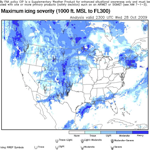
Hence John Fiscus, the Chief Pilot of The Flight Academy, has recently written a post on the Cirrus Owners & Pilots Association (COPA) blog listing a couple of useful resources to help USA based pilots make an informed decision about ice conditions in the air before leaving the ground. Some of the resources mentioned by John are listed under the icing tab on the ADDS (Aviation Digital Data Service) website and these resources include an icing airmets map and two other useful tools that measure maximum icing severity and the potential for icing at 7,000 feet. John does an excellent job of explaining how to use all of these tools that were created to help you plan a safe flight this winter.
[…] Useful icing resources for pilots […]